
Building a territory model
Read The two hierarchies first if you have not. This page assumes you know that a territory's depth and the size of the areas it is built from are independent.
What a model is
A territory model holds one complete territory structure. It has a name and a description, and it contains a tree of territories.
You can have several models at once, and they do not interfere. Sales and Service can both cover Ohio, in completely different shapes, and neither knows the other exists. Assignments are per model, so a record can belong to a territory in each.
⚠️ Because models never compare themselves to each other, nothing warns you if two models disagree. That is by design — they are separate answers to separate questions. It also means a mistake in one model is invisible from the other.
Planning one, before you draw anything
Three decisions, in this order. Two of them are expensive to change later.
1. How many tiers
Depth is free to change structurally — you can add a tier under any territory at any time — but every territory you add needs a boundary drawn, and a boundary is the expensive part.
A useful rule: a tier should correspond to something a person is accountable for. If nobody owns a tier, it is a folder, and folders belong in the name of the territory rather than in the tree.
2. How fine each territory should be
Per territory, not per tier. See The two hierarchies.
- Whole counties where the business does not split them. Fast to draw, fast to change, few pieces.
- Block groups where a metro has to be divided. Precise, and slow to redraw.
- Tracts are the middle option and are frequently the right one for a suburban split.
Draw coarse first and refine. A county-level model that is finished is more useful than a block-group model that is half drawn, and refining is re-selecting one territory rather than starting again.
3. What happens where nobody sells
Some of the map will belong to no territory, and that is normal. You have two choices and they are different:
- Leave it uncovered. Records that land there raise a
COVERAGE_GAPexception, which is a to-do list. See Coverage gaps. - Draw a catch-all territory over it. Records get assigned and nothing is raised.
Neither is wrong. Choose deliberately, because the difference decides whether you find out.
The model card, and its four buttons
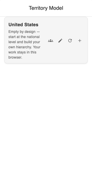
The model card's four actions, left to right: see every territory in the model, rename the model, redraw the map layers, and add a top-level territory.
| Button | Does |
|---|---|
| People | Lists every territory in the model at once, rather than making you walk the tree |
| Pencil | Renames the model and edits its description |
| Circular arrow | Redraws the map layers. Use it if the map and the tree look out of step |
| + | Adds a top-level territory |
🔴 The + on the model card and the + on a territory card do different things. The model's + adds a territory at the top; a territory's + adds a child under that territory. Getting them confused is the commonest way a tree ends up the wrong shape.
Naming the model
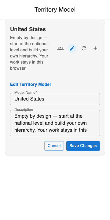
Renaming the model. The name is the one a Salesforce administrator sees on the Territory2Model record, so it is worth setting before anyone else opens it.
The model's name and the record's name are the same name. There is no separate "display name", so what you type here is what appears in Salesforce Setup, in reports, and in every list of models.
Adding a territory
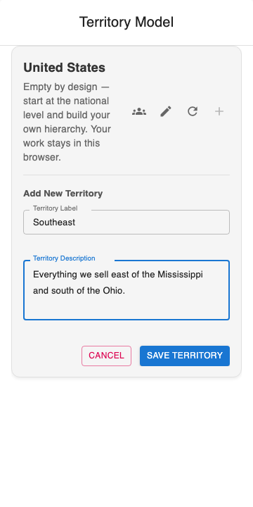
Adding the first territory. Only the label is required; the description is carried through to Salesforce and is worth writing while you still remember what you meant.
Press +, type a label, press SAVE TERRITORY. The territory appears in the tree immediately.
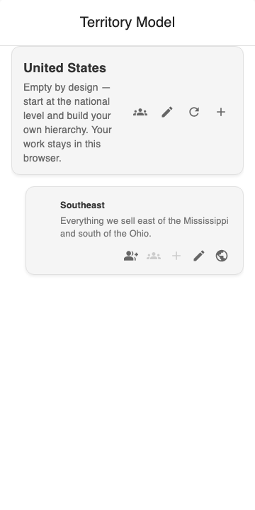
A territory, and its five actions: assign people, view its children, add a child, rename it, and — the green globe — turn on map management so you can draw its boundary.
| Button | Does |
|---|---|
| Person + | Assign people to this territory |
| People | Show everything beneath this territory. Greyed out until it has children |
| + | Add a child territory. 🔴 Greyed out until this territory has a boundary — see below |
| Pencil | Rename it and edit its description |
| Globe | Turn on map management, so clicks on the map select areas for this territory |
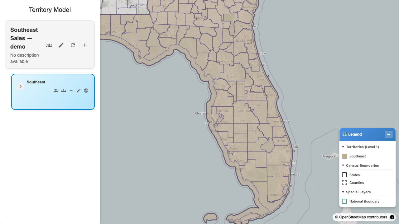
A model with its first territory drawn: the tree on the left, the boundary on the right, and the legend naming the one territory at this depth. One model, one tree.
🔴 The rule that catches everyone: map it before you can nest under it
A territory's + is disabled until that territory has a boundary. Hover it before you have drawn one and the tooltip says so:
You must map this territory first before adding sub-territories
So the order is always: create a territory → draw its boundary → then add children under it. You cannot lay out the whole tree first and draw the boundaries afterwards, which is what most people try.
It is not an arbitrary restriction. A child is drawn from the same census areas as its parent, so until the parent has some there is nothing for a child to be made of.
Adding a child
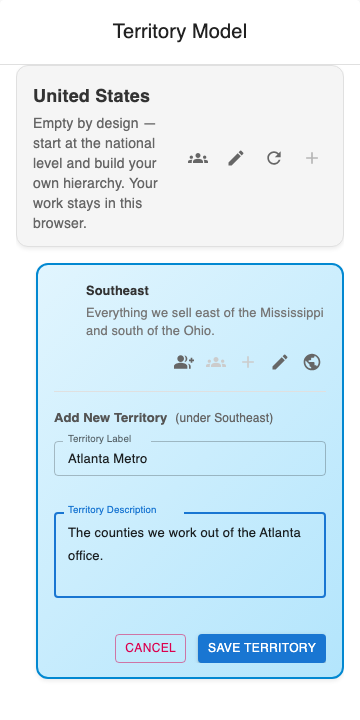
Adding a child. The form says who the parent is — "(under Southeast)" — because + on the model card and + on a territory card do different things.
Read the "(under …)" line before you type. It is the only thing on screen that tells you where the new territory will land, and it is the difference between a second top-level territory and a child.
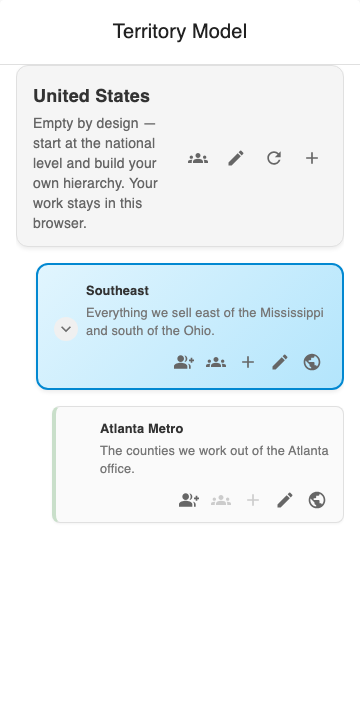
A two-tier model. A child territory is drawn from the same census areas as its parent; it is not restricted to a smaller census level because it is deeper.
Depth is unlimited. So is the number of children.
Seeing everything beneath a territory
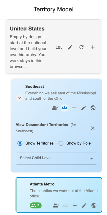
Everything beneath a territory, in one list, without walking the tree card by card.
Press the people button on a territory card. Select Child Level narrows the list to one depth.
⚠️ "Show by Role" is greyed out until functional groups are defined. It groups the list by what people do rather than by tree position, and it reads its list of roles from your functional groups — so with none defined there is nothing for it to group by. See Functional groups.
What happens to a neighbour when boundaries meet
If you select an area that already belongs to another territory, it moves. Immediately, silently, and without asking either of you.
The area is removed from the territory that had it and added to yours. Nothing is rejected, no warning is shown, and the other territory's owner is not notified.
This is intended — for a map tool, painting over a neighbour is the expected gesture — but two parts of how it currently behaves are worth knowing:
| 🔴 A territory reduced to nothing is deleted | If your selection covers all of a neighbouring territory, that territory is removed, not emptied. One box drag can delete someone else's territory |
| ⚠️ Its owner is never told | There is no notification and no audit entry. The only way to notice is to look at the map |
Both are owed remediation and neither is fixed today. Until they are: before a large drag over populated ground, look at what is already there.
Renaming, moving and deleting
| Action | Effect on the boundary |
|---|---|
| Rename a territory | None. The shape is unaffected |
| Add a child | None to the parent. Parents and children can overlap; nothing enforces containment |
| Delete a territory | 🔴 The boundary is orphaned, not deleted. See below |
🔴 Delete-and-recreate does not do what it looks like
A territory's boundary is stored outside Salesforce, keyed on the territory's record id. Delete a territory and recreate it with the same name and you get a new id — and the old boundary is stranded, still stored, belonging to nothing.
The same applies to cloning a territory model, which is the standard Salesforce realignment workflow: a clone has new ids throughout, so the clone has no boundaries at all and the original model's boundaries are not copied with it.
Until this is fixed, do not use clone-a-model as a realignment strategy, and prefer editing a territory over deleting and recreating it. If you have already done either, the stranded boundaries need clearing on the GIS side — see Troubleshooting.
Limits worth knowing
| Territories per model | No product limit. 🔴 Colour repeats after 20 territories in one sibling group, and there is currently nothing else to tell the repeats apart — the pattern fill intended for that is generated but not yet drawn. Read the legend rather than the colour |
| Depth | No limit |
| Models per org | No limit |
| Areas per territory | No hard limit. Hundreds are routine; thousands are slow to redraw |
| Overlap between models | Always allowed |
| Overlap within a model | Not allowed in intent, not prevented in practice — see the neighbour section above |
| Contiguity | Not required and not checked. A territory can be in several unconnected pieces |
Next
Drawing and editing boundaries — the part that takes the time.
Last verified: 2026-10-13 · Owner: MapKraken Labs LLC
Something on this page wrong, or a setup step missing? That is a documentation defect and we want it — tell us and this is the page that gets fixed.