
The two hierarchies
This is the page not to skip. Territory Mapper has two tree structures in it, they are unrelated, and almost every confusing thing the product does is explained by the difference. It takes five minutes.
The short version
There are two trees, and they have nothing to do with each other.
| Geographic areas | Your territories | |
|---|---|---|
| Who defines it | The US Census Bureau | You |
| Can you change it? | No. You select from it | Yes, entirely |
| How deep | Exactly four, fixed | As deep as you like |
| What the names are | Fixed | Yours |
| What it is for | The pieces territories are built from | The structure your business works in |
A territory is made out of geographic areas. It does not live inside the geographic tree.
The geographic tree — fixed, four areas, read-only
State → County → Census tract → Block groupFour sizes of area, nested inside each other, covering the whole United States. Every state is made of counties, every county of tracts, every tract of block groups. There are about 239,000 block groups.
You never edit these. You pick them, and the territory you are drawing becomes the sum of whatever you picked.
The map decides which size you are picking, from how far in you are zoomed. Zoomed right out you are picking states; zoom in and you get counties, then tracts, then block groups. There is a control to hold one size if you want to — see Drawing and editing boundaries.
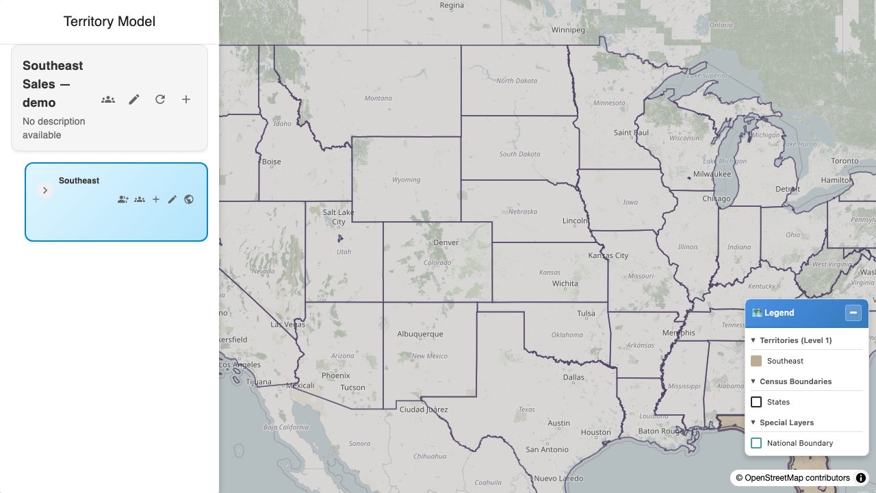
The whole country. At this zoom a click selects a state.
Your tree — yours, any depth, any names
A territory model is a named container: "Sales", "Service", "FY27 Plan". Inside it you build territories, and territories can contain other territories, as deep as you need.
Nothing about that structure is fixed. There is no required number of tiers, no required names, and no rule about what a tier means. Region → District → Territory is a common shape, and so is Country → State → Metro → Neighbourhood, and so is a flat list.
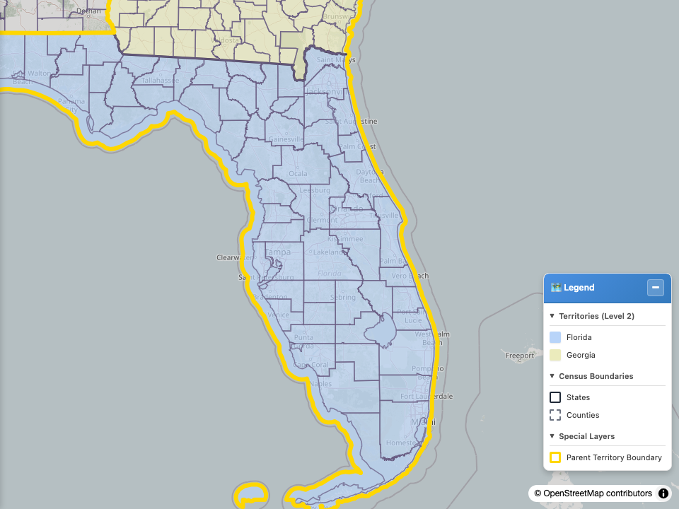
One state, and the three territories beneath it. Their boundaries are made of census areas — and, as the next section shows, not all of the same size.
🔑 The part that catches everyone
How deep a territory sits and how fine its boundary is are two completely separate things.
Neither one constrains the other. Two territories can sit side by side in your tree — same parent, same depth, peers in every sense — and be built out of areas four sizes apart.
Here is a model that does exactly that:
Territory model "Southeast Sales"
│
├── tier 1   Southeast              built from:  STATES
│   │
│   ├── tier 2   Florida            built from:  COUNTIES
│   │   │
│   │   ├── tier 3   Orlando Metro     built from:  COUNTIES      ← 3 of them
│   │   │
│   │   ├── tier 3   Tampa Inner Ring  built from:  BLOCK GROUPS  ← 456 of them
│   │   │
│   │   └── tier 3   Space Coast       built from:  COUNTIES      ← 1 of them
│   │
│   └── tier 2   Georgia            built from:  COUNTIES
"Orlando Metro" and "Tampa Inner Ring" are siblings. Same parent, same tier, next to each other in the tree. One is three whole counties. The other is 456 block groups — the finest areas there are, hand-picked to make a ring around downtown Tampa. As territories they are peers. As shapes they could not be less alike.
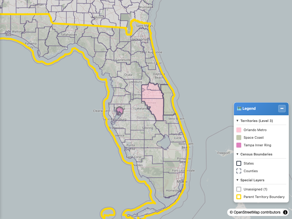
Two sibling territories at the same tier. The one on the right follows county lines. The one on the left follows block-group lines, which is why its edge is so much more intricate.
And it works the other way too: "Florida" (tier 2) and "Orlando Metro" (tier 3) are both built from counties. Same size of area, different depths.
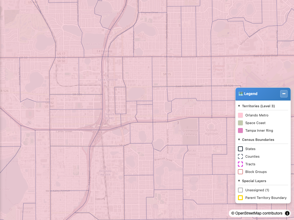
Zoomed all the way in. The territory boundary follows census edges exactly, because it is made of them.
Why it is built this way
Because real sales territories are like that. A rural region is fine at county resolution and a dense metro is not, and forcing both to the same resolution means either a boundary that cuts through a city or a model with a hundred thousand pieces in it.
What it means for you
- Pick the size that suits the territory, not the size that matches its neighbours.
- A tier number tells you nothing about a boundary's precision. If you need to know how fine a territory is, look at it on the map.
- Mixing sizes inside one territory is allowed too. A territory can be two whole counties plus a handful of block groups from a third.
Where the two trees actually meet
In exactly one place: a saved territory is the merged outline of the areas you picked.
When you save, the areas are fused into a single shape and the interior lines between them disappear. That shape is what the map draws and what records are tested against.
⚠️ The list of areas you picked is not kept. Once saved, the territory is a shape — the product cannot tell you afterwards "which block groups are in Florida?", and re-selecting is how you change a boundary, not editing a list.
Two consequences worth knowing before you build something large:
- To change a boundary, you re-select and re-save it. There is no per-area edit.
- A territory drawn from many small areas is expensive to redraw, because redrawing means picking them again.
A note on words
The app says "level 2" where this documentation says "tier 2". They mean the same thing.
The reason for the difference: level is genuinely ambiguous here — it could mean a depth in your tree or a size of census area, and those are exactly the two things this page exists to keep apart. The documentation uses tier for your tree and census area for the geography. The app has not caught up yet.
See Vocabulary for the full list.
Last verified: 2026-08-09 · Owner: MapKraken Labs LLC
Something on this page wrong, or a setup step missing? That is a documentation defect and we want it — tell us and this is the page that gets fixed.